When a trip is well thought out it usually ends well. It was just a couple of decades ago when everyone used a paper map to plan their travels. Google was not on anyone’s phone to view it all virtually, so most people did not do a lot of fact-checking.
Having Good Data Matters
This introduction leaves me in front of my barn at the farm around 1995 working on a planter. It was mid-May and a beautiful day. I saw a brand-new Cadillac come by my place at a slow rate of speed then stop on the rural highway. I could see a lone driver looking at a paper map, and then the road signs at the intersection just ahead. He looked perplexed, so I stood up where he could see me. He then backed into my barn entrance and ran towards me. He said my daughter graduates from High School at Friendship, Texas in 20 minutes and I can’t seem to find it. I asked only one question: “You said Friendship, Texas?” He said, “Yes, and I have to be at this graduation as I haven’t seen her in almost a year.” My heart sank for this poor fellow because the community of Friendship had not been in existence for almost 60 years but was still on some maps. However, there was a thriving school outside of Lubbock, Texas known as Frenship High School. It was 55 miles from where we were standing. When I relayed the message, the man looked broken.
I do not know how that drama ended, but it does emphasize that for us to arrive at the desired destination then we must know the underlying data is correct. In either case, I see Nebraska as an opportunity where data can make sure that farmers arrive at the correct destination involving water issues.
Why Nebraska?
A little background is necessary if the reader is not a resident of rural Nebraska. The Nebraska Department of Natural Resources through research have determined that groundwater development in the Upper Platte Basin has caused river flows to decrease. Nebraska law, enacted in 2004 requires a process for the Upper Platte Basin NRDs (Natural Resource Districts) to have a detailed plan in place, known as an IMP (Integrated Management Plans), to return the river to 1997 conditions by 2029. The Twin Platte Natural Resources District (TPNRD) was able to meet the requirements under the first IMP which had a duration of 10 years, from 2009 to 2019. The second IMP requires an even larger amount of offset water to be returned annually to the Platte River by September 2029.
The Twin Platte NRD (TPNRD) second increment IMP is being jointly developed by the TPNRD and the Nebraska Department of Natural Resources (NE DNR) in collaboration with local stakeholders. The current draft of the second increment IMP provides for education programs and mandatory data collection in the TPNRD beginning in 2019. It is the opinion of the Board, and Management, of TPNRD that better data for groundwater models could lower the required additional offset water, and may prevent regulations from being required.
Partnered for a Solution
To achieve the data collection requirements TPNRD has partnered with GiSC (Grower Information Services Cooperative), local well drillers, and local electrical power providers for all of their producers. This program is the first of its’ kind in the state!! Partners working together to gain knowledge utilizing on-farm technology such as electric smart-meters to avoid costly controls for their producers.
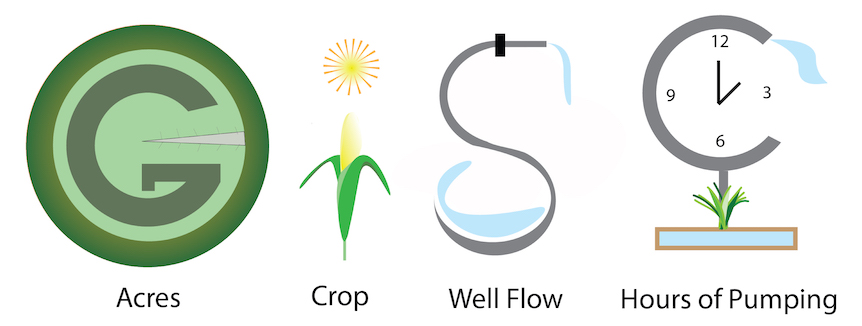
TPNRD has entered into an agreement with GiSC for collecting water use data. GiSC is a producer-owned data cooperative and is governed by a board of farmers. Together TPNRD and its producers have partnered with GiSC to bring TPNRD Irrigated growers a new Water Data Program. This program will be an evolving digital service that automates the collection of high-quality water usage data. GiSC’s digital platform will track the producer’s acres, crop type, well flows and the hours of pumping (via Electric Smart Meter). The expected outcome is more accurate modeling of the water utilization which is to the producer’s advantage. GiSC is so pleased to have the partnership with TPNRD who we have found is committed to serving their stakeholders, including our producer members, and making sure they are utilizing the best data for analysis.
In conclusion, irrigators in Nebraska can’t afford to take a gamble utilizing incomplete data. It will be an interesting time working on something that provides our GiSC members with a way to automate data collection and usage for their long-term benefit. I applaud growers for their proactive stance, and I applaud TPNRD for giving them an opportunity to put better data into the stream flow models related to groundwater use in agriculture.
By: Billy Tiller Founder/CEO GiSC